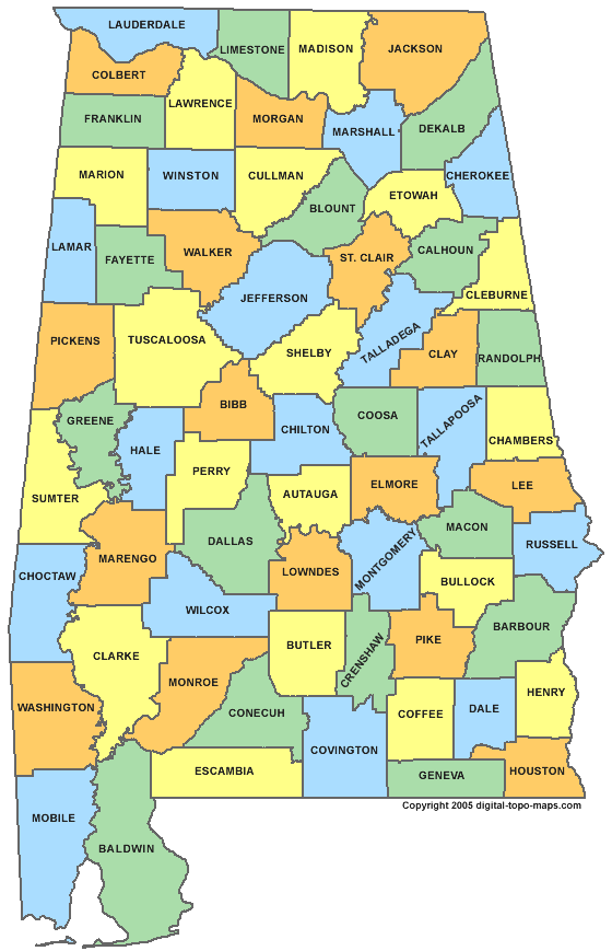
File:Alabama-county-map.gif
Jump to navigation
Jump to search

Size of this preview: 386 × 599 pixels. Other resolution: 560 × 869 pixels.
Original file (560 × 869 pixels, file size: 36 KB, MIME type: image/gif, 0.2 s)
Map courtesy of Digital-Topo-Maps.com.
Licensing[edit | edit source]
 |
This image is under copyright by the owner, Digital-Topo-Maps and is used by permission under the condition that the copyright is listed and attribution is given. This work is not subject to any Creative Commons license. |
File history
Click on a date/time to view the file as it appeared at that time.
| Date/Time | Thumbnail | Dimensions | User | Comment | |
|---|---|---|---|---|---|
| current | ★ Approved revision 10:20, 10 September 2010 | | 560 × 869 (36 KB) | Murphynw (talk | contribs) | Map courtesy of [http://www.digital-topo-maps.com/county-map/ Digital-Topo-Maps.com]. |
You cannot overwrite this file.
File usage
The following 3 pages use this file: